Habitat Mobile Mapping
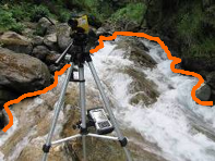
Repetitive detailed maps are created under multiple flows conditions by using a Rangefinder, a pocket PC and GPS positioning.
 The habitat attributes are collected and geo-referenced during each mapping campaign for each sampled area (or hydromorphologic unit - HMU). Habitat descriptors can include biotic and abiotic variables, but also stream reach and site characteristics such as shore vegetation and land use.

M9 ADCP (Acoustic Doppler Current Profilers)
To study hydraulic conditions in natural rivers, lakes, intake channels of power plants, flow velocity measurements are performed along transects by using the ADCP, Sontek M9 River Surveyor, San Diego, CA, USA.

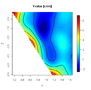
The measurements show the flow pattern across the river sections and the flow velocity values in each defined cell.

ADV - Sontek (Acoustic Doppler Velocimeter)
ADV is designed to record instantaneous velocity components at a single-point with a relatively high frequency. Measurements are performed by measuring the velocity of particles in a remote sampling volume based upon the Doppler shift effect (ADV, Sontek, San Diego, CA, USA.

In a standard configuration, the sampling volume is about a cylinder of water with a diameter of 6 mm and a height of 9 mm, although newer laboratory ADVs may have smaller sampling volume (e.g. Sontek microADV). The signal strength, SNR (signal-to-noise ratio) and correlation values are used primarily to determine the quality and accuracy of the velocity data, although the signal strength (acoustic backscatter intensity) may related to the instantaneous suspended sediment concentration with proper calibration. The velocity component is measured along the line connecting the sampling volume to the receiver.
Aquatic fauna observation
Underwater visual census, electrofishing, nets and traps are used to observe aquatic fauna in their habitat. We also applied fish telemetry to associate habitat characteristics to fish presence.

